Things to Do Near an Iceland Glacier: Trails, Waterfalls and Stops
Most of what surrounds the ice costs you nothing but the parking. If you came looking for Iceland glacier tickets, this is the other half of the trip: the park’s trails at Skaftafell, the waterfalls the day tours stop at, and the peak above them all.
The Skaftafell trails, from easy to hard
Skaftafell is the park’s hiking area at the foot of Vatnajökull, on Route 1. The park marks ten trails from here, from a half-hour stroll to a ten-hour trek. You pay the regional parking fee once and walk as many as you like that day.
| Trail | Length | Time | Grade |
|---|---|---|---|
| S1 Skaftafellsjökull (glacier view) | 4.1 km loop | 1 to 1.5 hours | Easy |
| S2 Svartifoss, Sjónarsker and Sel | 5.8 km loop | 2 hours | Easy |
| S3 Skaftafellsheiði | 16.6 km loop | 5 to 6 hours | Challenging |
| S4 Krístínartindar | 18 km loop | 6 to 8 hours | Difficult |
| S5 Sjónarnípa | 6.5 km loop | 2 to 2.5 hours | Challenging |
| S6 Svartifoss and Sjónarnípa | 7.1 km loop | 2.5 to 3 hours | Challenging |
| S7 Gömlutún | 1.6 km | 0.5 to 1 hour | Easy |
| M1 Bæjarstaðarskógur | 15.3 km | 4 to 5 hours | Long day |
| M2 Morsárjökull | 19.5 km | 6 to 7 hours | Long day |
| M3 Kjós | 30 km | 8 to 10 hours | Long day |
Check before you set off. The park closed the Austurbrekkur trail for maintenance through September 2026, and in spring it shuts muddy paths to protect them. The rangers at Skaftafellsstofa, the visitor centre by the car park, know what is open that morning.
Svartifoss and its basalt columns
Svartifoss is the waterfall you have seen on a postcard: a thin fall dropping over a wall of dark, regular basalt columns. The park explains how they formed. About 300,000 years ago lava flowed down Skaftafellsheiði and filled an old river bed. It cooled slowly, shrank and split into columns standing at right angles to the surface it cooled against.
You reach it on trail S2, a 5.8 km loop of about two hours, graded easy. On the way up you pass two smaller falls, Hundafoss and Magnúsarfoss. Loop back by Sjónarsker for a view across the whole outwash plain, and past the old turf farm at Sel. If you have three hours, S6 adds the Sjónarnípa viewpoint over the glacier.
The glacier you can walk to without crampons
Trail S1 takes you to the front of Skaftafellsjökull, an outlet glacier of Vatnajökull, in a 4.1 km loop of an hour to an hour and a half. It is part of the park’s Melting Glaciers project, which follows the retreating ice. In 1940 this glacier and its neighbour still wrapped round the hill of Hafrafell.
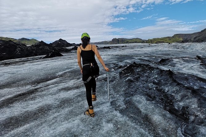
Stop where the path stops. The park’s advice for walking on the ice is to go with a guide who has glacier experience. The longer guided hikes from the national park car park go onto Falljökull, with crampons, a harness and an ice axe in the fare.
The South Coast stops on the Reykjavík days
If you join a glacier day from Reykjavík, the drive east is part of the day. The hike days and the sightseeing day stop at the same three places on the way to Sólheimajökull and back.
- Seljalandsfoss
- The waterfall you can walk behind, weather permitting. The hike day from central Reykjavík allows about 30 minutes. Wear your waterproofs.
- Skógafoss
- A 60-metre drop from what was once the coastline, with 527 steps up to the top. About 40 minutes on the hike day and 30 on the sightseeing day.
- Reynisfjara
- Black sand, basalt columns and the Reynisdrangar sea stacks. About 40 minutes on the hike day and 30 on the sightseeing day. Watch for sneaker waves.
At Seljalandsfoss, bring a layer you do not mind soaking. Skógafoss is the one to climb if you have the legs for 527 steps. On Reynisfjara, stay well back from the water: unpredictable sneaker waves run far up this beach.
Want the waterfalls and the ice in one day?
The South Coast hike days stop at all three and put you on Sólheimajökull in crampons between them.
The Golden Circle stops on the snowmobile day
The Golden Circle day with a snowmobile ride stops at three sights before and after Langjökull. Its itinerary gives about an hour at Geysir.
- Þingvellir National Park. The first stop out of Reykjavík, on the drive east.
- The Geysir geothermal area. About an hour among the hot springs before the drive up to the ice.
- Gullfoss. The river Hvítá drops into a 32-metre-deep canyon here. You stop here again on the way back.
Know the trade before you book. One traveller found the stops rushed, at about 30 minutes each, and wrote that the snowmobile made up for it. If you want longer at the sights, drive the Golden Circle yourself and join a snowmobile at Geysir.
Hvannadalshnúkur and Öræfajökull
The ice cap above Skaftafell hides a volcano. Öræfajökull erupted in 1362, the largest pumice eruption in Iceland’s recorded history, and destroyed the settlement below. It erupted again in 1727. The district was renamed Öræfi, which means wasteland.
Hvannadalshnúkur, the highest peak in the country, rises on Öræfajökull. The park says its trail begins at Háalda by Sandfell; ask the rangers before you plan it. Falljökull, where the longer hikes go, creeps down from the caldera, whose edge stands about 1,800 metres up.
Getting between the stops
Distances decide how much of this fits into one trip. The operators give about two hours, 165 km, from Reykjavík to Sólheimajökull, and 4.5 to 5 hours to the Skaftafell bases. The park puts Kirkjubæjarklaustur 70 km west of Skaftafell and Höfn 130 km east.
So the South Coast waterfalls sit on the way to Skaftafell, not beside it. If you are driving the ring road, see them on the day you drive east, and keep the Skaftafell day for the ice and the trails.
What is free and what is not
Walking costs nothing here beyond the parking. What you pay for is anything that needs a guide, a boat or a bed.
| What | What you pay | Who charges |
|---|---|---|
| The Skaftafell trails, S1 to M3 | Parking only: 1,110 ISK a car | The national park |
| The lagoon shore and the beach across the road | Parking only: 1,110 ISK a car | The national park |
| Camping at Skaftafell | ISK 2,800 a night, ages 17 to 66 | The national park |
| Standing on a glacier | A guided fare, from $96 | A tour operator |
| Going out on the lagoon | A boat or kayak fare, from $232 | A tour operator |
| The South Coast waterfalls and beach | Nothing extra on a day-tour fare | Built into the tour |
Asked about the stops
How long is the walk to Svartifoss?
Which Skaftafell trail goes to a glacier?
Which is the hardest trail at Skaftafell?
Can you walk behind Seljalandsfoss?
Is Reynisfjara dangerous?
Where is Iceland’s highest peak?
Where these facts come from
The trails, the lengths and grades, the Svartifoss geology, the eruptions and the distances are the national park’s own, read 23 September 2026. The waterfall and beach details and the stop times come from each tour’s own itinerary.
- Skaftafell: access, trails and destinations (national park)
- The black-column waterfall and trail S2 (national park, in Icelandic)
- Pricelist: the regional fee, camping and permits (national park)
Next: plan the rest of the trip with the lagoon and the beach, see where to base yourself, or compare every fare on Iceland Glacier Tours.